
ALTON/GODFREY/HARDIN - A tornado watch has been issued for all of the region until 10 p.m. CDT, as storms developing north of Quincy and in northern Missouri could intensify and move toward the St. Louis area later Wednesday night, June 17, 2026, according to the National Weather Service in St. Louis and meteorologist Jared Maples.
The National Weather Service in St. Louis issued the tornado watch on Wednesday afternoon, June 17, 2026. The watch includes parts of Illinois, specifically Madison, St. Clair, Montgomery, Calhoun, Greene, Jersey, Macoupin, Brown, Pike, and Adams counties, as well as the cities of Litchfield, Alton, Belleville, Jerseyville, Edwardsville and St. Louis.
Get The Latest News!
Don't miss our top stories and need-to-know news everyday in your inbox.
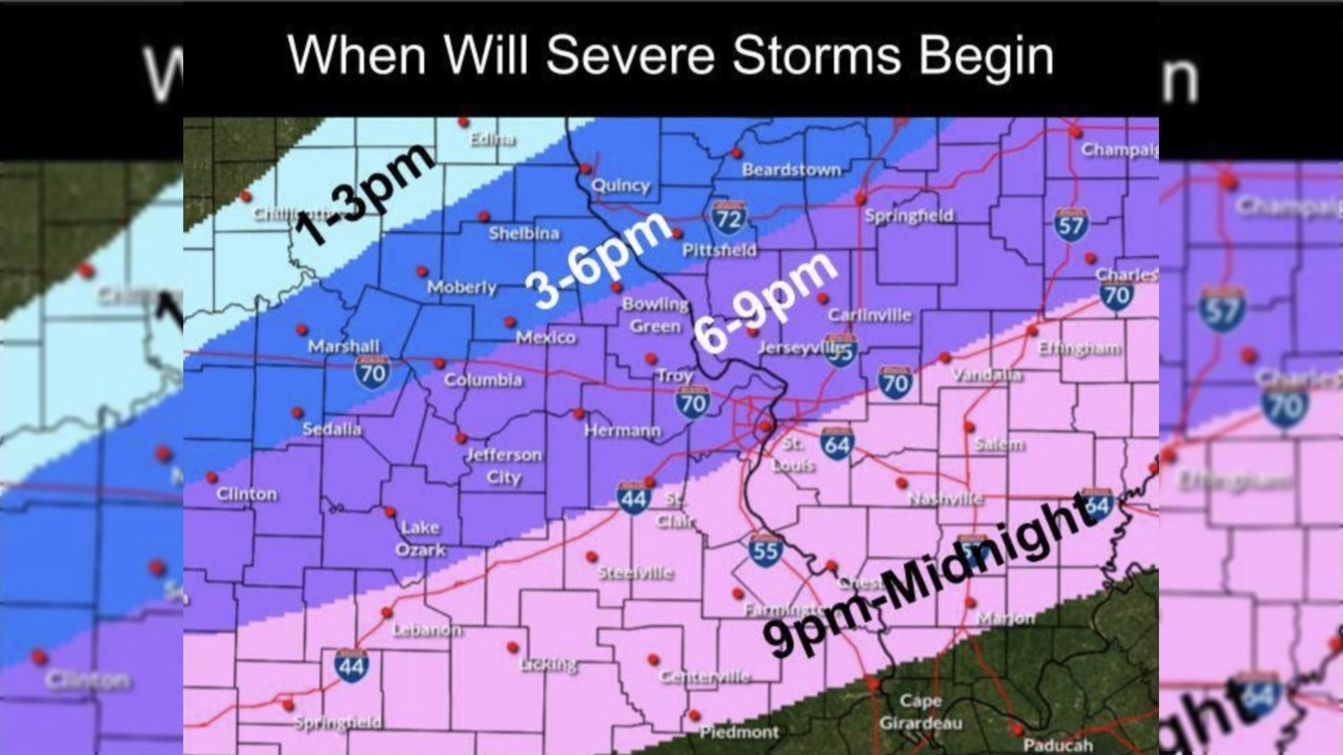
Maples said a cold front is moving in and storms are developing to the north around Quincy, northern Missouri, and the west-central area. He said some of those storms could become “pretty intense” within an hour, with hail, tornadoes, and damaging winds all possible.
“All those hazards generally north of I-70,” Maples said, adding that there is uncertainty about how soon the storms will develop and whether the threat could extend farther southeast.
Maples said the system could approach the St. Louis area from the northwest, with the latest timing around 7 to 8 p.m. in the metro area.
He said there is potential for “at least a couple of storm tornadoes if the right things happen in the storm," and warned people not to let their guard down this evening.
“Especially in the grand scheme of things, tornadoes are a low probability, but if we do get hit, it can be especially serious.”
Temperatures are expected to drop on Wednesday night, with lows largely in the 60s. Maples said lows should be in the mid- to upper 60s south of Interstate 70 and in the low to mid-60s farther north.
He said Thursday, June 18, 2026, is expected to be cooler, with highs in the low 80s and lower moisture levels.
Maples also said the next round of weather is more concerning for heavy rain from Sunday, June 21, 2026, into Monday, June 22, 2026.